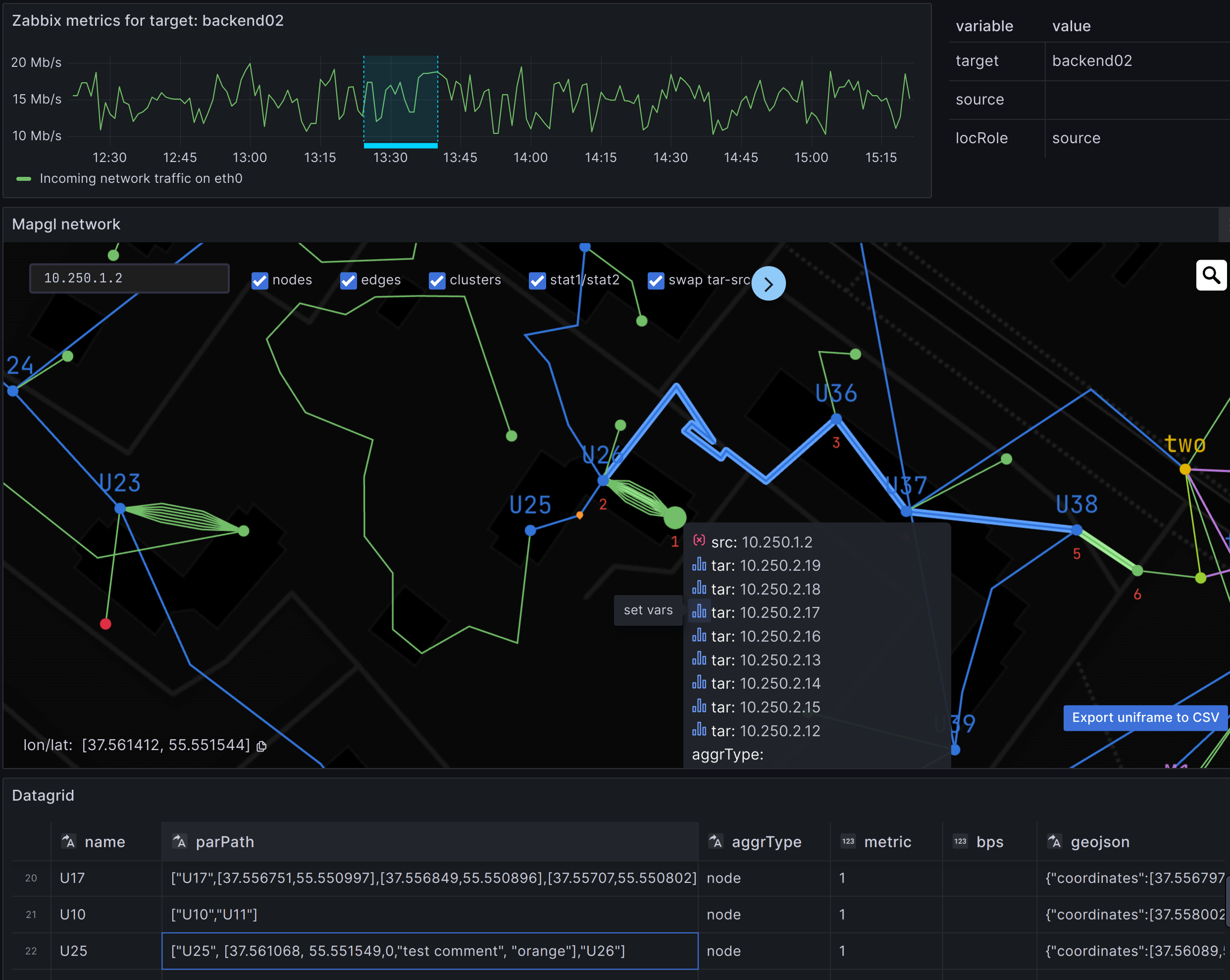
Мониторинг сети на геокарте и графе#
📡 Физическая топология#
- связи между устройствами с агрегацией в волоконно-оптические линии (ВОЛС)
- маршруты на геокарте из нескольких сегментов
- иконки кластеров со сводной информацией о статусах групп устройств
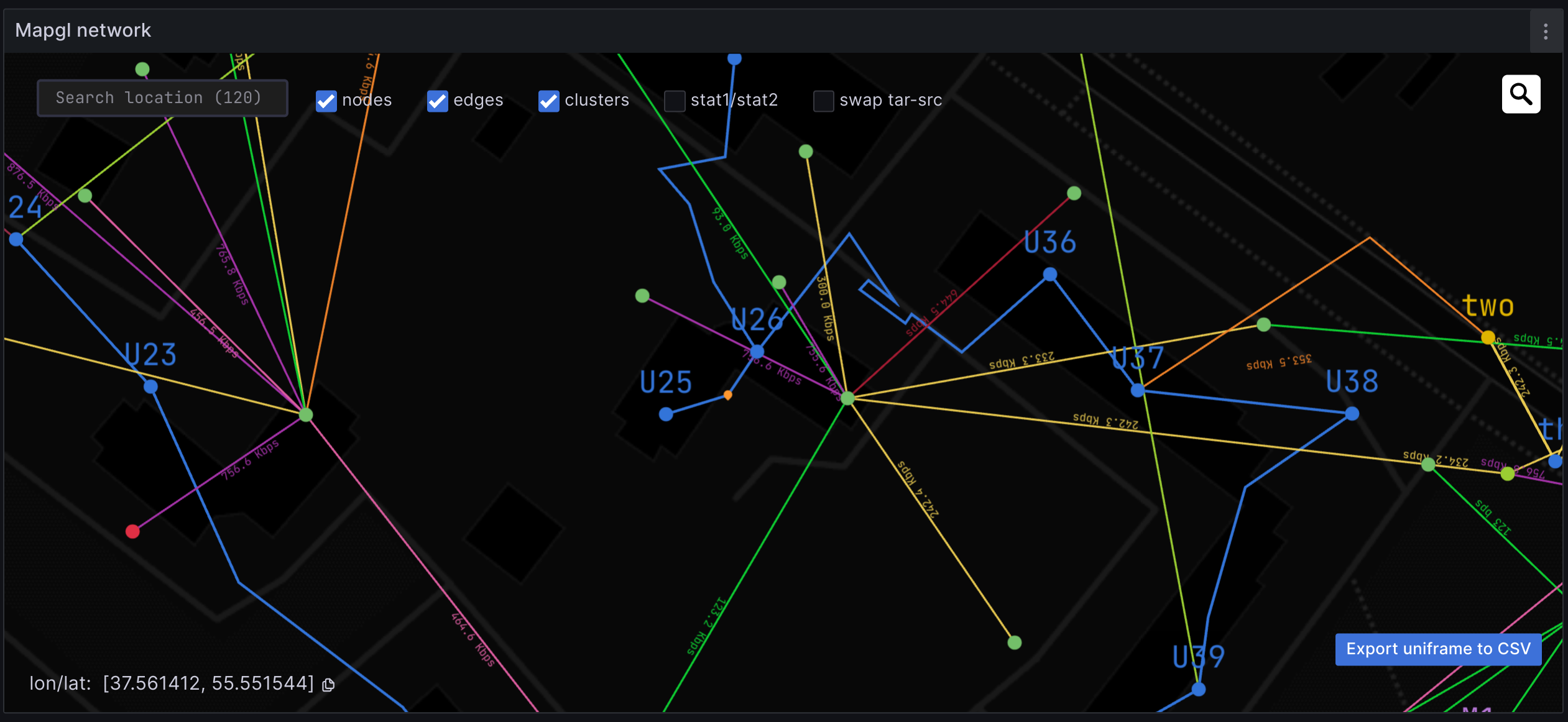
🕸️ Логическая топология#
- авто построение графа устройств и связей. Поддержка namespaces в виде под-графов.
- параллельные, вложенные связи с отображением линка с мин/макс значением метрики
- визуализация нагрузки на линк двухцветными арками
- динамические ссылки на внешние панели (drill-down datalinks)
Mapgl интегрирован в эко-систему Grafana в качестве плагина, позволяя использовать любые источники метрик и инструменты трансформации, гибко настраивать стили с помощью универсального пользовательского интерфейса Grafana.
🎛️ Grafana Field Config#
- Thresholds — диапазоны значений метрик с соответствующими цветами
- Mapping — переименование отображаемых значений
- Units — конвертация единиц измерения
- Overrides — пользовательские настройки для отдельных метрик
- DataLinks — ссылки на внешние дашборды или графики
Динамическое определение цветов, размеров, толщины линий и иконок на основе правил, зависящих от значений метрик или других параметров.
Правила могут применяться глобально или переопределяться для конкретных метрик или групп устройств
📄 Формат данных#

Запись в исходном датафрейме должна содержать:
idикоординатыузла. Не требуется при автогенерации графаparent idили полный путь с указанием промежуточных id узлов или координатid интерфейса— опционально. Используется для поддержки параллельных связей- метрика
статуса - метрики
transmit/receiveдля отображения нагрузки на линк
🛠️ Подготовка данных#
Используйте встроенные трансформации Grafana для подготовки и объединения данных из:
- Postgres
- Prometheus
- Zabbix
- Любых других источников данных
Tutorial: мониторинг Zabbix событий на геокарте Netbox+prometheus и datalinks, демо
🕹️ Демо#
Интерактивные панели с открытой конфигурацией
💲 Прайс#
📸 Скриншоты#